
Embark on an unforgettable journey through the heart of Pisgah National Forest with the John Rock Loop hike. This moderately challenging trail rewards adventurers with stunning panoramic views from the summit of John Rock, a prominent mountain overlooking the Fish Hatchery. Prepare to be captivated by a picturesque waterfall, tranquil meadows near Picklesimer Fields, and vibrant wildflower displays in spring, making this hike a scenic highlight of the region.
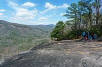 Panoramic view from John Rock summit showcasing the valley and Pisgah Ridge
John Rock Loop Hike: At a Glance
Difficulty: Moderately Difficult (Rating: 7.59)
Distance: 5 miles round-trip
Trail Condition: Moderately Rough
Ascent: Steep Climbs
Lowest Point: 2350 feet
Highest Point: 3320 feet
Total Elevation Gain: 1000 feet
Type: Loop Trail
Start/End Point: Pisgah Center for Wildlife Education (Fish Hatchery) Parking Area
Trails Included: Cat Gap Loop, Cat Gap Bypass, John Rock Trail
Getting to the John Rock Trailhead
Navigating to the John Rock trailhead is straightforward. Here are detailed directions to guide you:
From Asheville, NC:
- Begin on I-240 West and merge onto I-26 East.
- Take exit 40 for Asheville Airport.
- Turn right onto NC 280 and continue for 16 miles towards Brevard.
- At the intersection with US 276 and US 64, turn right onto US 276 West (follow signs for Pisgah National Forest).
- Drive 5.2 miles on US 276 West and turn left onto Forest Road 475 (FR 475).
- Continue on FR 475 for 1.4 miles to reach the Pisgah Center for Wildlife Education and Fish Hatchery.
- Turn left, cross the bridge, and find parking in the designated lot.
Open in Google Maps to plan your route directly.
Hiking the John Rock Loop: A Detailed Trail Guide
Starting Your Ascent
Begin your John Rock adventure by locating Forest Service Road 475C, situated to the left of the main building as you face it from the parking lot. Walk around the gate and immediately cross a distinctive log bridge treated with creosote. Just past this bridge, turn right onto the Cat Gap Loop Trail to officially start your hike.
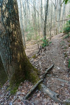
The initial segment of the Cat Gap Loop immediately engages you with a climb, including some log steps that quickly elevate your heart rate. Soon, the trail levels out, transitioning into a gently undulating path. To your right, a green chain-link fence marks the boundary of a forest demonstration area. Take a peek inside to observe some of the few remaining healthy hemlock trees in the vicinity, which have been treated to combat the hemlock woolly adelgid infestation that has devastated many others along the trail. The path crosses a minor stream, typically easy to rock-hop across, though it has become wider and muddier over time.
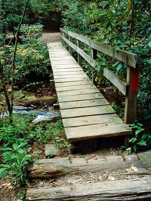 Wooden footbridge crossing Cedar Rock Creek on the John Rock Loop trail
The surrounding forest showcases a diverse mix of tree species, including cove hardwoods like tuliptree and oak, alongside white pine, shortleaf pine, and the remnants of hemlock forests. Notably, the forest floor is often covered in Lycopodium, commonly known as “ground pine” or “running cedar.” These ancient plants, once towering trees, now resemble miniature forests at ground level. Their spores are highly flammable and historically used in photography flash bulbs.
Cedar Rock Creek and Waterfalls
Continuing along, you’ll reach a footbridge spanning Cedar Rock Creek. Cross it, then briefly cross a gravel road before rejoining the Cat Gap Trail on the opposite side. A short, moderately steep climb leads to an old roadbed. From here, the trail widens into an eroded path that gradually ascends along the valley side.
As you proceed, you’ll pass above the weir that diverts water to the fish hatchery, visible below to your left. The pristine, cold waters of Cedar Rock Creek are essential for nurturing trout at the hatchery.
Sections of the trail are naturally tunneled by rhododendrons arching overhead. The path veers away from the main valley, entering a side cove, and then crosses a subtle ridge. Soon, the sound and, increasingly visible through the now sparse hemlock canopy, sight of Cedar Rock Falls will emerge on your left. The trail passes a popular, though somewhat worn, campsite with a small cascade nearby; the primary Cedar Rock Falls is just downstream.
(A path descends from the campsite to the base of the main falls. Take the left fork where the path edges over a small drop-off for a safer descent. Visiting the base of the falls is rewarding, but exercise extreme caution around waterfalls and slippery rocks due to high drop-offs.)
Picklesimer Fields and Valley Junction
Beyond the campsite and Cedar Rock Falls, the Cat Gap Loop trail leads to a junction with the Butter Gap Trail, marked by a large rock slab within a grove of surviving Eastern Hemlocks (as of 2019). While the John Rock Loop directs you left across a bridge, staying on the Cat Gap Loop, consider a brief detour right to explore Picklesimer Fields. This area resembles a smaller version of Pink Beds, featuring slow-moving streams meandering through open, shrubby meadows.
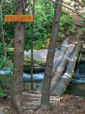 Cat Gap Loop Trail sign with a wooden bridge and lush greenery
Returning to the rock slab, follow the Cat Gap Loop left across a log bridge equipped with a cable handrail. This point marks where the gentle stream begins its descent over Cedar Rock Falls. You’ll then head upstream into the valley’s southern arm along Cedar Rock Creek. Be aware of potential wildlife; a rattlesnake was spotted near the trail in this area in May 2013, a habitat they favor.
The trail crosses the creek again via another log bridge, entering a planted stand of white pines with minimal undergrowth, a favored camping spot. Continue left, upstream.
Another creek crossing awaits, now often a muddy and widened rock-hop. Past this, the trail steepens significantly, veering left (east) up the mountainside, ascending onto a ridge nose via a heavily eroded path. Switchbacks aid the climb up this unnamed ridge, though erosion persists with some root and rock sections.
The forest transitions to older mixed hardwoods typical of these elevations. Dense undergrowth of mountain laurel and rhododendron makes off-trail travel exceedingly difficult and poses a fire risk. Fire suppression has increased this undergrowth; the Forest Service sometimes uses controlled burns to manage fuel loads and open such areas, a role wildfires naturally fulfill, albeit more dramatically.
Cat Gap Bypass and the Ascent to John Rock
As the intense climb eases, you’ll intersect with the Cat Gap Bypass trail. Turn left onto the Bypass. (Continuing straight on Cat Gap Trail leads to the Art Loeb Trail northeast of Cedar Rock Mountain in Cat Gap).
The Cat Gap Bypass traverses a high slope beneath Cat Gap, at the head of John Rock Branch, around 3100 ft elevation. It offers a quicker, easier route to the John Rock Trail than navigating through Cat Gap. The trail passes through varied forest types in quick succession. Oak trees dominate ridge sections, while cove areas feature tuliptree and, formerly, hemlocks. Winter offers glimpses of John Rock’s side through the trees.
 Lush green cove along the Cat Gap Bypass Trail
You’ll reach a four-way junction in a deep gap south of John Rock. Turn left onto the John Rock Trail. (Right leads to the other end of Cat Gap Loop from Cat Gap and Art Loeb Trail; straight ahead, also Cat Gap Loop, descends into Horse Cove).
The John Rock Trail initiates a steep ascent to an unnamed knob on the ridge towards John Rock. Though switchbacks or a route skirting the knob would improve it, the current trail is rocky, eroded, and root-crossed. One section is a steep scramble over a jumbled rock pile. Fortunately, this challenging part is brief.
Summit Views from John Rock
After cresting the knob, a gradual descent begins towards John Rock. This point, around 3320 ft, is the hike’s highest. The trail undulates slightly as it approaches John Rock’s cliffs. At a T-junction, the yellow-blazed John Rock Trail turns right. Continue straight to reach the overlook. Trees thin and vanish as you emerge onto John Rock’s face.
Extreme Caution is necessary here! A 200 ft sheer drop awaits. Enjoy the view from the forest edge safely, especially ensuring dry rock conditions. Wet rocks, leaves, pine needles, moss, and algae are significant slip hazards.
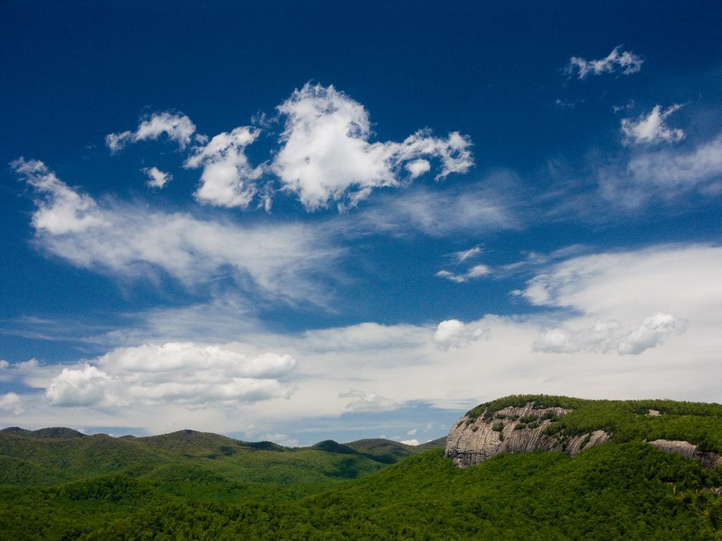 Sweeping vista of Looking Glass Rock from the summit of John Rock
Revel in the northward view across the valley towards Looking Glass Rock and the Fish Hatchery below. Binoculars can enhance the experience, perhaps spotting your car in the parking lot! To the northwest, observe Pisgah Ledge and its extending ridges. Northeast of Looking Glass Rock is Coontree Mountain, and to its right, Bearpen Mountain.
Descent and Return
After absorbing the views, head northeast along the woods edge to the right, rejoining the trail for the descent in a generally southeastern direction.
The path meanders through a large, gently sloping area east of John Rock, then descends slightly into a cove dense with rhododendron and mountain laurel undergrowth.
 Mountain Laurel in full bloom alongside the John Rock trail
From this cove, the trail ascends slightly again, crossing into the next cove before commencing a serious descent. It bottoms out at a Horse Cove Creek crossing via a precarious log bridge, reaching the eastern junction with the Cat Gap Loop Trail on the other side. Turn left, downhill.
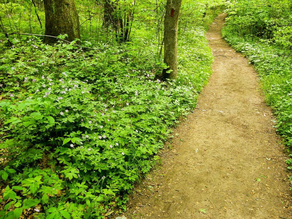
The lush forest here is dominated by tall tuliptrees, a hallmark of Cove Hardwood forests. Hemlocks once thrived in the shade, awaiting canopy dominance, but most are now gone. This cove is renowned for spectacular spring wildflowers.
You’ll reach an intersection with FS road 475C; cross straight over, continuing on the Cat Gap Loop Trail downhill to another stream crossing, this time a rock-hop.
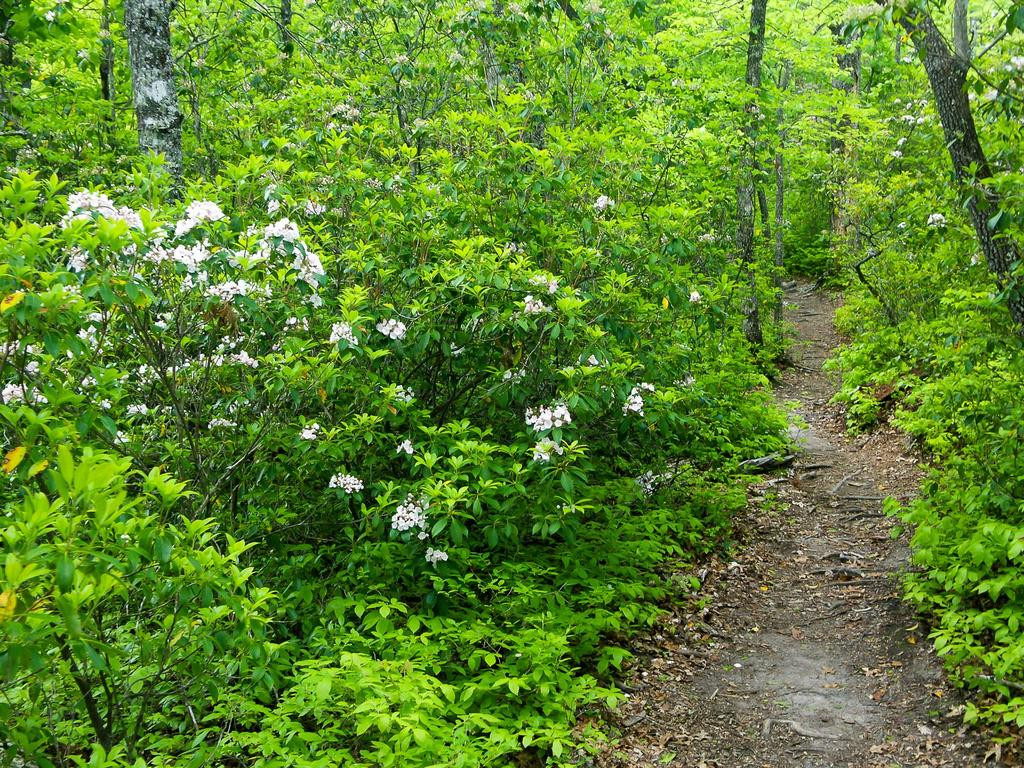
 Vibrant wildflowers lining the Cat Gap Loop trail in Horse Cove
Horse Cove levels out near its confluence with East Horse Cove, and the trail exits the cove’s mouth, running upstream beside the Davidson River’s gentle flow.
Though a slight uphill grade exists here, it’s barely noticeable after the earlier climbs. This trail section on John Rock’s north side is damp, with small streams and seeps crossing beneath the trail to the river. Rhododendron and doghobble thrive in the understory.
Once dominated by hemlocks, this forest section is reverting to cove hardwoods, with few mature hemlocks remaining as of 2019.
Near the hike’s end, a large campsite appears on your right. (Falling dead hemlocks may temporarily detract from its appeal). It’s also a pleasant spot to relax by the river post-hike.
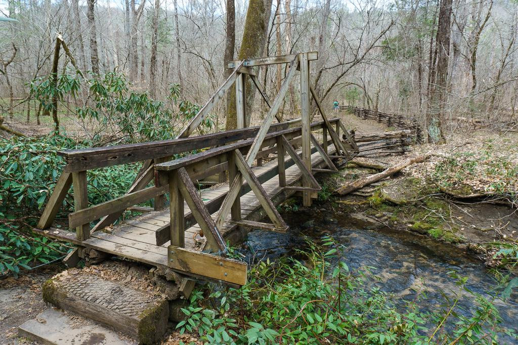 Unique triangle-beam bridge on the Cat Gap Loop trail
Conclude your John Rock Loop hike by crossing the distinctive triangle-beam bridge over Cedar Rock Creek. A short distance further, you’ll emerge from the forest at the eastern end of the Pisgah Center for Wildlife Education parking lot, completing your loop.
Explore More Photos from the John Rock Hike
View the full gallery of images from the John Rock Loop Hike.
John Rock Loop Trail Map & GPS Data
[Interactive Trail Map and GPS Data Downloads are available here] (Map section from original article can be linked or embedded here if possible within website framework).
Share Your Experience and Read Feedback
[Link to comments/ratings section from original article to maintain community engagement].
The John Rock Loop hike offers a diverse and rewarding experience within Pisgah National Forest. From its cascading waterfall and wildflower meadows to the breathtaking summit views, it’s a trail that encapsulates the beauty and challenge of the North Carolina mountains. Plan your visit to John Rock and discover why it’s a beloved destination for hikers seeking natural splendor and invigorating trails.